The best homeschool geography curriculum is the one that you use and enjoy! A personalized, free homeschool curriculum can be created by you at home, and you can have geography fun with your kids with these world homeschool geography ideas. When a geography lesson becomes real, you will always find time to learn geography at home. Make homeschool geography for kids fun: play the best geography games for kids, read about cultures with beautiful geography books for kids, and my favorite, explore the world through family travel!

With two teacher parents, my brother and I spent summers learning real-life US geography lesson through travel. School world geography curriculum lessons didn’t stick because they didn’t mean anything. It’s the same with our homeschool kids (and us!) and our homeschool ideas. Let’s learn how to teach geography meaningfully and bring world cultures to life. People matter. Let’s meet them.
Keep reading and share this page with your homeschool family friend who needs a reminder.
~~~> Interested in reading more about how we homeschool? Check out this huge list of all the homeschooling related posts located on the Reclaiming Wonders blog!

~~~> Not a full-time homeschooler? Stick with me! All the resources and ideas below can be applied to summer learning, after-school activities, and weekend adventures. This is family learning for every family.
Affiliate disclosure: When you click and purchase a link in my post, I may earn an affiliate commission at no extra cost to you. I promise to only recommend products or places that I have personally want, used, or researched. Thanks in advance for the gallon of gas. 😉
Why is Learning Geography Important?
Homeschool subjects that the homeschool family finds important are the ones that will get done. Unfortunately, geography is often pushed aside because it isn’t on standardized tests or one of the main subjects like “reading, writing, and ‘rithmatic”. This is a school subject that needs even more attention.
It’s so easy to get overwhelmed with geography homeschool curriculum. Which curriculum is best? Or should you buy homeschool geography printable? Or maybe you’re like me – a homeschool mom who, seeing all the options, chooses not do anything because what if you get the wrong version?! The fear of imperfection keeps us from even choosing a curriculum to start with.

Quit wondering if geography should be taught in schools or even why is it important to learn geography. This is one subject that will impact our daily lives no matter whether reading books, watching news, working in business, meeting new people, traveling abroad… It’s everywhere. Learning geography is something that homeschool parents can do right with to their kids.
Geography is important no matter your age.
Not to mention, Jesus said preach the word to the ends of the earth. Don’t you think you need to know about the people who live there? And become well-rounded students who love other people no matter where or how they live!
~~~> Want to spend your homeschool curriculum money the best way? Let’s plan a road trip with “10 Tips to a Family Road Trip with Less Stress” and take learning on the road with “Learning through Carschooling”.
How to Learn Geography for Free
Homeschool geography curriculum free? Get a good list of books from around the world to lead you to some beautiful picture books. Non-fiction books and biographies are introduce you to the real history of real people who lived there. Your kids may not remember the specific country names, but they will remember stories. “The boys who fled their country after their parents were attacked” still made an impact, and they still learned geography!

Real. Living stories.
Find some good websites, do a Google or Pinterest search, and start making a library list. My favorite method is simply to search for a country on the library search engine. I do avoid all the “school” looking books with the dry facts and boring pictures. Give me the beautifully illustrated biographical picture books anytime.
If you are looking to add some kid activities to your travel picture book list, head to see some of the beautiful unit studies offered by my friend Jamie at Around the World in Homeschool Days.
~~~> Make sure you read “5 New Ways to Use Picture Books”. It’s the reminder you need that everyone can learn from beautiful picture books!

My Favorite World Geography Books
Check out these beautiful world geography books about the countries and people of our world. Open the world to your kids by making it about real people, places, and stories. This approach is sooo much better than learning dry facts. You don’t need allll the book; you just need great one. Here’s your list.
- Material World: A Global Family Portrait
- Hungry Planet: What the World Eats
- Window on the World – Operation Prayer Resource
- Give Your Child the World
- The Usborne Geography Encyclopedia with Complete World Atlas
- Indescribable Atlas Adventures
These are some great non-textbooks to show your kids the world that will grow along with them. While the kids are young, read these books together, and find places you discuss on the map. When they’re older, these books are a great option for research and looking over all the statistics.

~~~> Ready to bring some fun back into your homeschool days? This homeschool veteran of 10+ years has a list for you of more than 100 Free Field Trip ideas! Click through.
Geography Book #1: Material World: A Global Family Portrait
Although the geography book Material World: A Global Family Portrait is a bit outdated (from 1994), it is still one of the best travel books in my geography collection. The author and a team of photojournalists travel around the world taking pictures of average families in countries all over the world. The selected families all bring their worldly possessions out in front of their dwelling to be photographed and share their family’s story.
Make sure you look over the graphs and statistics in the back of these book. Use this as a launching pad to discuss new terms like literacy rate, infant mortality, life expectancy, population doubling time, and per capita income. There’s even a page comparing different bathrooms around the world. The insights this coffee-table sized book gives into the different cultures are unmatched.

“But showing only the best and the worse provides just one small part of the world pictures. I wanted to give some insight into the rest of the world… We all have an understanding of what our own lives are like, but even as the countries of the world become more interconnected, we know very little about the lives of other people in other societies.”
Peter Menzel in Material World
Geography Book #2:
Hungry Planet: What the World Eats
Similar to Material World, Peter Menzel travels the world in Hungry Planet, but he shows what each family eats weekly. Meeting 24 families from 30 countries, learn about each culture through the stories and their food. As each country is about six to eight full-spread pages, there’s so much information!
Each family in Hungry Planet is photographed with all their food for the week – garden-fresh vegetables, rations from their refugee camp, family-raised meat, or packages from the grocery story. It’s a great way to see into different lives, and the chapter even includes a percentage of their income they spend on each kind of food.
The data in back of the Hungry Planet is as well-done as in Material World. Especially if you have older kids, use this section to read state. Learn about access to safe water, safe sanitation, and health care expenditures while looking at rates of obesity, diabetes, alcohol consumption, and even number of McDonalds.

Geography Book #3:
Window on the World – Operation Prayer Resource
Window on the World is a great tie into the photos and families of Hungry Planet and Material World. This book focuses on unevangelized countries and people groups from around the world. Each of these 92 places has a two page, full-color spread with maps and photos and facts. This is an easily understood book with a larger font and bite-sized info for younger students. Consider using this in combination with Operation World’s prayer calendar; there’s a different country every day.
As the only Christian geography book on this list, Window on the World gives specific things to pray for each country. There are facts and history about each country with real stories about hardships faced due to religious persecution. This is a great way to introduce world religion into your learning in a way that most geography books will not.
~~~> Want to know the best way to get kids interested in geography? Let them go on a mission trip to learn how to love the people of the world. And read “Mission Trips: Should My Teenager Go?“.

Geography Book #4:
Give Your Child the World
Give Your Child the World by Jamie Martin (2016) is a top recommended book in the homeschool world. With each chapter broken up by continents, it’s further subdivided as it moves from younger to older readers. Whether you’re looking for a picture book to read together or a chapter book to hand to your kid, there are soooo many books to choose from here.My only complaint about this book is that I do wish it were organized merely by country, but this is an excellent jumping off place!

Geography Book #5:
Indescribable Atlas Adventures
This is my newest addition to my geography bookshelf! Indescribable Atlas Adventures: An Explorer’s Guide to Geography, Animals, and Cultures Through God’s Amazing World was just released in 2024, and it by Louie Giglio who also brought us the favorite homeschool science devotionals Indescribable, How Great is our God, and The Wonder of Creation. The layout of these science books is similar to this new atlas with full color illustrations of animals and the world. It’s really beautiful.
Each of the fifty countries represented are full of easily-read information including language, food, culture, population, animals. I plan on using this with my upcoming Classical Conversations Challenge A student as he learns to draw the whole world. It’s easy enough for younger kids and detailed enough for big kids (and mom) to enjoy.
and if you still think you need an official geography textbook, try…

Geography Book #6:
The Usborne Geography Encyclopedia with Complete World Atlas
Usborne non-fiction books are beautiful and lovely, and the Usborne Geography Encyclopedia is one of the best Usborne books. This internet-linked textbook makes geography easily understood. Starting with the broad picture of our planet, move through geographic land differences and ecology, discusses each continent’s people and culture. With beautiful color pictures and maps, the Usborne Geography Encyclopedia allows further research into the countries and regions in the geography books above.

Best World Geography Maps and Resources
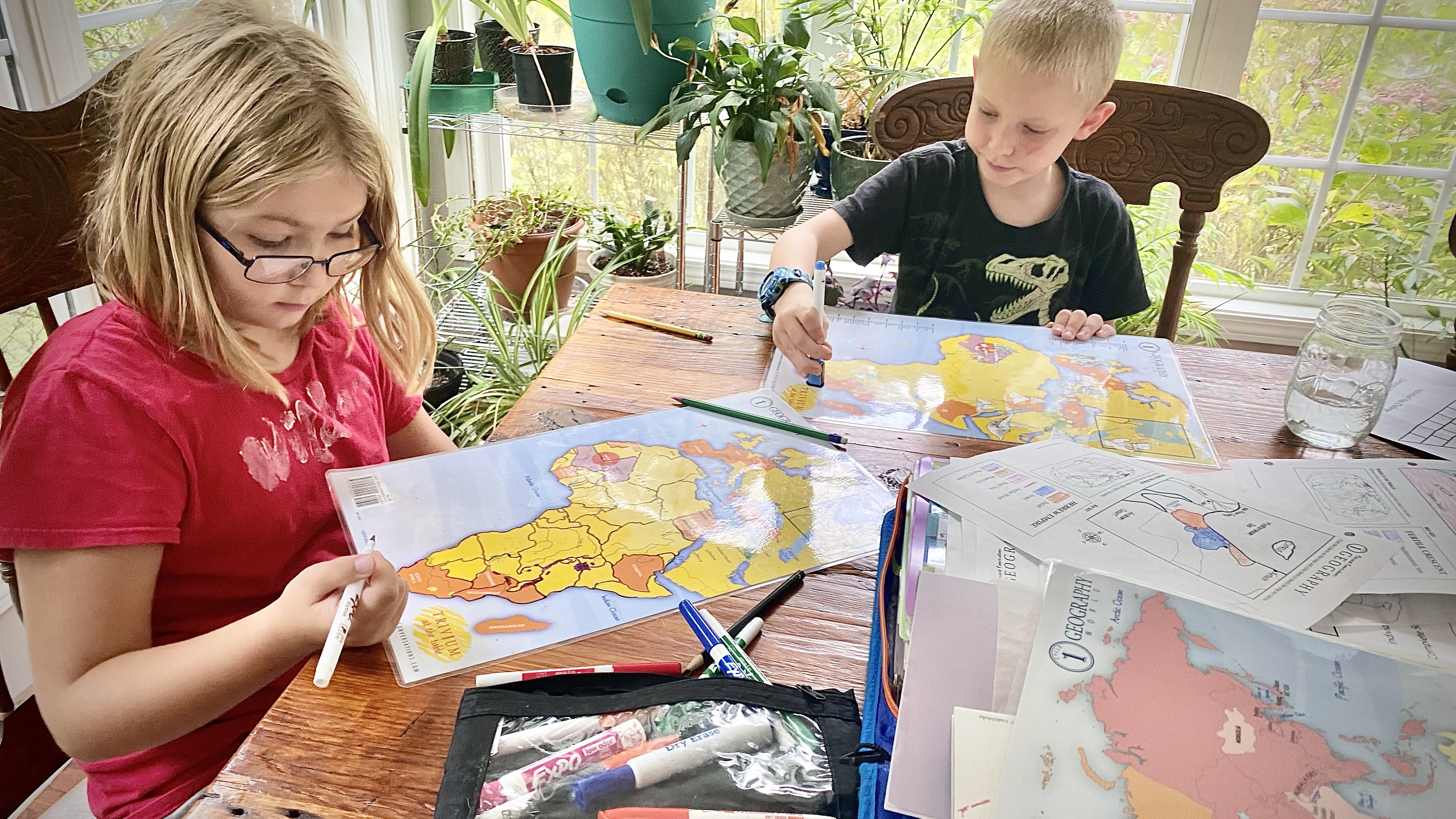
During our twelve years using Classical Conversations as the foundation for our homeschool curriculum, geography is memorized on a weekly basis as we learn to locate places on the map. To make geography an active part of your family learning life, you need maps easily accessible. All the time! Get many and look at them often.
In our homeschool life, maps are frequently out for coloring or referencing as we read through events and stories from around the world. We have a wall map in most rooms of our house including the four kid bedrooms. Do all homeschoolers have too many maps, or are we just really weird?! 🙂

Eatsleepdoodle World Map – This tablecloth-size fabric world outline map comes complete with fabric markers. Let the kids roll it out and color while you read some beautiful picture books or from a geography book listed above.
World Shower Curtain – This large-scape map is one of my all-time best homeschool purchases that we use almost every day! As a see-through shower curtain map, this map can be referenced while still letting in light through the windows in our dining room. Because it’s vinyl, we can write on it with a dry erase marker if we need to track something. We love this map! Looking to be able to hold a globe? Check out this inflatable globe – perfect for little hands… and some games!
Best Map PuzzleS FOR KIDS – Learning with geographic puzzles are a great way to get kids familiar with their world and keep their hands busy. Mine love to pull out this Usborne Animals of the World Map Puzzle when we’re reading around the table at morning time. When the kids are ready for the next step, grab these country-shaped GeoPuzzles; these durable continent map jigsaw puzzles are perfect for little and big hands alike.

Geography Laminated placements – These durable, laminated world maps allow for geography memory work while eating. These are also perfect for tracing with a dry erase marker or on tracing paper. Not only will they last longer, but if used as true placemats, you can quiz each other while eating. Sneaky fun for sure. These black and white laminated line maps would work for quizzing or tracing too.
Inflatable Globe – Imagine learning about a place where everyone has easy access to a globe. Play other game with a blow-up globe. Sneaky learning and a fun way to incorporate some geography learning. No room for a globe? Get a good atlas like National Geographic Student World Atlas.
~~~> Looking to get your kids involved in world-wide projects, shop throughout the year for Samaritan’s Purse Christmas boxes to send gifts around the world. If your teens are old enough, you might even be close enough to volunteer as a family at the Operation Christmas Child operations center. All the details on this post.
Extras to Make Geography Fun!
Although this homeschooler likes to keep it simple, some of these little extras might be just what your little learners will remember in the years to come.
- Track your learning with a pretend US passport complete with country stickers.
- Subscribe to Little Passports or Atlas Crate for a monthly adventure to your mailbox. These little activities are a great intro into countries for little kids. Track them on your wall map!
- Get snacks from around the world delivered to you with Universal Yums or Try the World.
- Tune in every day for world news with CNN-10 (free) or World Watch News (paid).
- Track your own travels with a scratch off US map or world map.
- Make a music play list and have a global dance party!
- Declare it TV schooling day. Travel through Rick Steve’s travel shows, eat the world with two LOTR faves (Billy and Dom Eat the World), and see the Coolest Places on Earth with these beautiful episodes.

Ready for adult geography fun? Dream about a year-long worldschool adventure with I’ve Never Been Here Before by Ashley Campbell. This book is full of the author’s beautiful travel photography and personal stories of their world adventure. Gotta dream! The beautiful Travel Book from Lonely Planet is on my dream list – so many beautiful places!
Fun World Geography Phone Games
When you have some excellent geography games online on your phone, any waiting time becomes learning time! Download (or play the online version), and you just added learning to the car trips and doctor’s appointments. Carschooling at its finest! These geography map games keep track of scores; competing against mom is extra motivation for this geography learning.

Seterra – Seterra is a free phone or online map game is great learning for all continent and country maps, flags, rivers, and landmarks. It teaches and quizzes knowledge in a fun way. You’ll find homeschool mom playing it as much as the kids! Also check out their free printable map through the website.
Globle – Globe is a web-based world geography game that is different daily as you play hot-and-cold with a different mystery country. Recall countries as you try to get closer to figure it out the country of the day. This is for more experienced geographers who already are familiar with geography.
Geoguessr – GeoGuessr is one of the best geography apps. You are dropped somewhere in the world through photographs. Using clues, narrow down the location while competing against yourself and friends.
Duolingo – Yes, I know that the amazing language app Duolingo is not officially a geography app, but learning a different language encourages kids to learn more about their world. Although, it can be quite progressive in its stories (aka gay characters) which keeps some conservative families from using this language app, I still say go for it. Honestly, my kids notice, and it gives us some conversations. But this app is used more consistently by my family than any other program. All six of us have daily streaks of more than 400 days. Get the paid version SuperDuo; you can really learn so much faster!
Favorite World Geography Games for Kids
Family board games bring family fun and learning; check out these family favorite geography games. These hands-on US and world travel games will help with not only identifying country and state locations, but the family fun will make it memorable. And don’t look for them in the educational section. These are popular games!

- Trekking: The World – Collect tokens as you travel the world.
- Ticket to Ride – So many versions! We have the original Ticket to Ride across the US, Ticket to Ride Europe, and Ticket to Ride United Kingdom. There are even more options available!
- Pandemic – Yes, this isn’t technically a “geography” game, but how better for high school geography to stick than curing the world of a pandemic as you work with the CDC. 🙂 This one is tricky!
- Election Night – This is a family geography game for big kids. This is math and geography and government all wrapped together. Perfect for a high school government class.
- The World Game – This family geography trivia game has been on my list, but I admit to not having played it. Maybe I’ll give it to us for Christmas this year!
~~~> Trying to justify game time as learning? (You know you are!) Then you need to head over to my “Gameschool: 10 Tips to Make Games a Priority.“
A Final Plea for Geography…
Geography should be more than coloring a map and regurgitating a country name for a test. No more learn and dump. Our world is so much more than that! Pair some amazing world books and lots of real-world adventuring with discussion. Add in some fun learning with TV schooling. Geography is everywhere; go discover it!

DIVE IN TO MORE WORLD-LEARNING WITH THESE TIPS. MAKE GEOGRAPHY PART OF YOUR FAMILY CULTURE AND LEARNING LIFESTYLE IN A WAY THAT WILL MAKE YOUR WHOLE FAMILY EXCITED TO TAKE ON THE WORLD.
Need Help? Reach out and I’d love to answer any questions.
Check Out These Related Posts

Thanks for stopping by my little corner! Here’s to your next adventure.
I’m Bobbie. As transplants from Texas, my family of six is on a mission to discover all of Georgia’s amazing places, experience amazing road trips across the United States, and create a homeschool life along the way.
Want to adventure like me? Reach out! I’d love to chat. Stop by my Instagram or Pinterest page to discover more of our adventures.
Want to work with me? I’d love to work with your destination and tourism board to help other family travelers see all you have to offer.
Leave a Reply